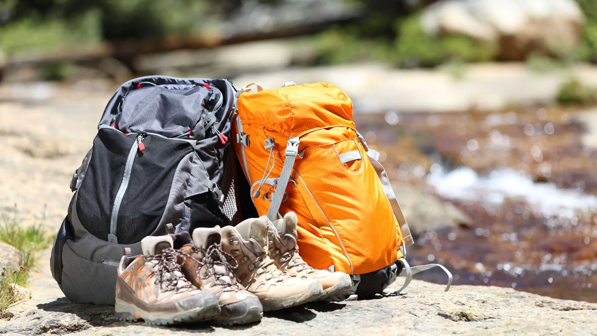
Are you looking for a great way to get your family outdoors? Cleveland may not be known as an outdoor travel destination, but Northeast Ohio has an abundance of beautiful hiking trails to choose from. Take a stroll alongside Northeast Ohio’s marshes rivers and lakes, wander through Cleveland Metroparks, climb rocks at the ledges, take in waterfall views, and you can even go on a treetop canopy walk if you’re looking for an interesting change of pace.
Table Of Contents
Best Places To Hike In Northeast Ohio
I grew up in Chardon Ohio which is a small town about 30 minutes east of Cleveland. Since then I’ve lived in Willoughby, Mentor, Parma, Medina, Lakewood, Elyria, and downtown Cleveland. Throughout the years, I’ve hiked almost every trail from Ashtabula to Sandusky.
It really is a shame how most people view Cleveland once you travel outside Northeast Ohio. We may have caught the Cuyahoga River on Fire 50 years ago, but we’ve put a lot of money into our local parks to make up for it. Maybe I’m biased, but I would put Northeast Ohio’s hiking trails up against 90% of the country.
We may not have mountain views or desert landscapes, but what we do have is a little piece of paradise. There are 100s of beautiful trails in Northeast Ohio and here are a few of my favorites.
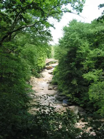
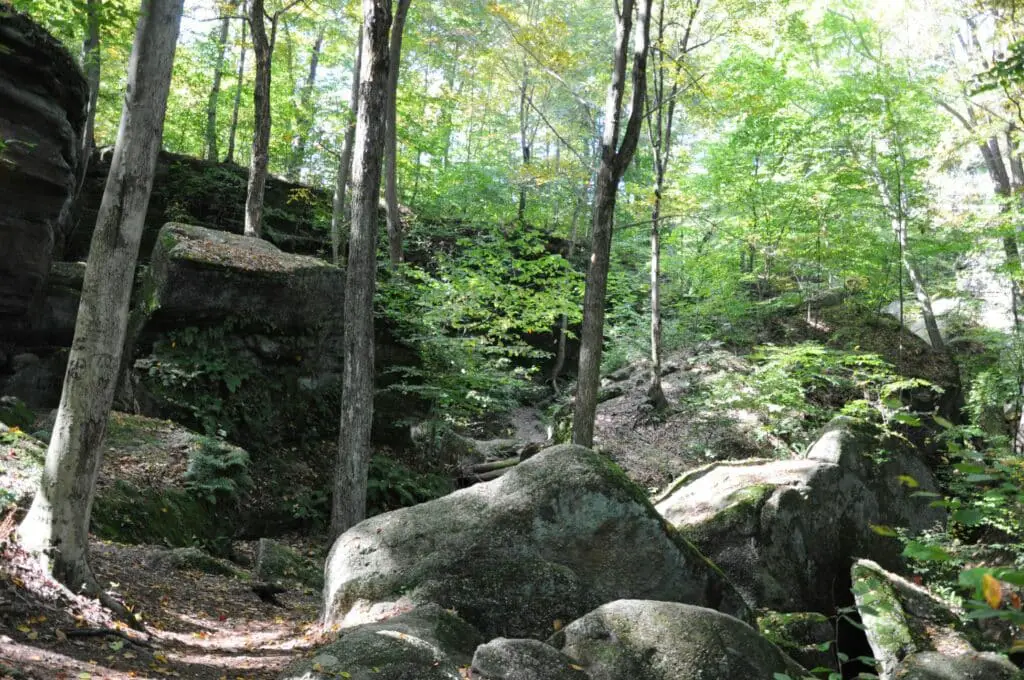
1. Ledges Trail (Ritchie Ledges)
- Location: Peninsula Ohio (Cuyahoga Valley National Park)
- Trail Length: 1.7-2.3 Mile Loop
- Difficulty: Intermediate
- Completion Time: 55 minutes
- Nearby Trails: Pine Grove Loop (4 miles), Brandywine Falls Loop (1.4 miles), Blue Hen Falls Trail (1.2 miles), Deer Lick Cave Loop (3.7 miles), Salt Run Trail (3.4 miles)
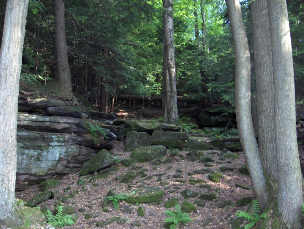
Ledges trail (aka Ritchie Ledges) is one of the most scenic trails in Cuyahoga Valley. It’s considered a moderately challenging trail due to the rocky landscape, but it’s well worth the effort. Just make sure you have decent footwear, because it’s steep in spots and can get slippery on the moss covered rocks.
Hike through the fern-filled hemlock trails, explore moss covered rock formations, walk through Ice Box Cave, climb the massive rock staircase, and take in the views at the cliff ledge overlook. You may also want to keep an eye out for the petroglyphs that date back to the 1900’s.
If you time your trip right, ledges trail offers one of the best views of the Cuyahoga Valley. I recommend taking this hike around autumn and trying to catch the sunset view over the valley. This is a fairly short trail so I recommend checking out a few of the other trails you can find at Cuyahoga Valley National Park, while you’re in the area.
2. Brandywine Falls Loop
Location: Peninsula Ohio (Cuyahoga Valley National Park)
Trail Length: 1.4 Mile Loop
Difficulty: Easy
Completion Time: 1hr 10 minutes
Nearby Trails: Pine Grove Loop (4 miles), Ledges Trail (1.7 miles), Blue Hen Falls Trail (1.2 miles), Deer Lick Cave Loop (3.7 miles), Salt Run Trail (3.4 miles)
While we’re talking about Cuyahoga Valley National Park, let’s talk about another great local trail. Brandywine falls and Brandywine Gorge Trail is just around the corner from Ledges Trail. CVNP is one of the best parks in Ohio so I recommend checking out the nearby Salt Run Trail, Pine Grove Loop, and Deer Lick Cave while you’re in the area.
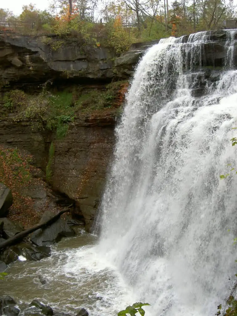
Brandywine falls is an easy hike hike down a 1.4 mile loop towards Brandywine Falls. This is a busy trail so it’s best done early or late in the day to avoid the crowds. It’s a relatively flat trail down a well maintained boardwalk that leads to Brandywine Falls. Just be careful, because the boardwalk can get slippery when wet.
Enjoy the 65 foot waterfall which is one of the most impressive waterfalls in Ohio. Take a side trip down the Brandywine Gorge Boardwalk to get a better view of the falls. Brandywine Gorge trail offers a completely different experience, where you’ll find yourself immersed in a dense forests running along sandstone and shale cliffs covered in moss and lichen.
Just be careful, because there isn’t a bridge crossing Brandywine Creek. Some people decide to take a dip in the creek, but there’s also a stone path that you can hop across. You may also want to
3. Mohican Trail 6 Mile Loop
- Location: Loudonville Ohio (Mohican State Park)
- Trail Length: 5.9 Mile Loop
- Difficulty: Moderate
- Completion Time: 2hr 30 minutes
- Nearby Trails: Covered Bridge To Pleasant Dam (2.3 miles), Lyons Falls (11.1 miles), Mohican Hog Hollow trail (4.6 miles), Hemlock Gorge Loop (11.9 miles)
Mohican trail is a 6 mile loop that goes down multiple trails splitting off along the way. There are actually several trails that form the Mohican Loop trail. You start at the covered bridge parking area and take Hog Hollow Trail towards the fire tow. It’s a gradual 3/4 mile climb leading to a steep 1/4 mile climb and rolling hills through rest of the loop.
Keep an eye out for the mountain bike trail and the equestrian trail that takes you over to Lyons Falls. There are usually a small handful of people on the mountain bike trail so keep an eye out for bikers riding in the opposite direction. The hike to Lyons Falls adds 2 miles up a steep hill, but it’s a large low flow waterfall with a recessed cave behind it, so it’s worth checking out.
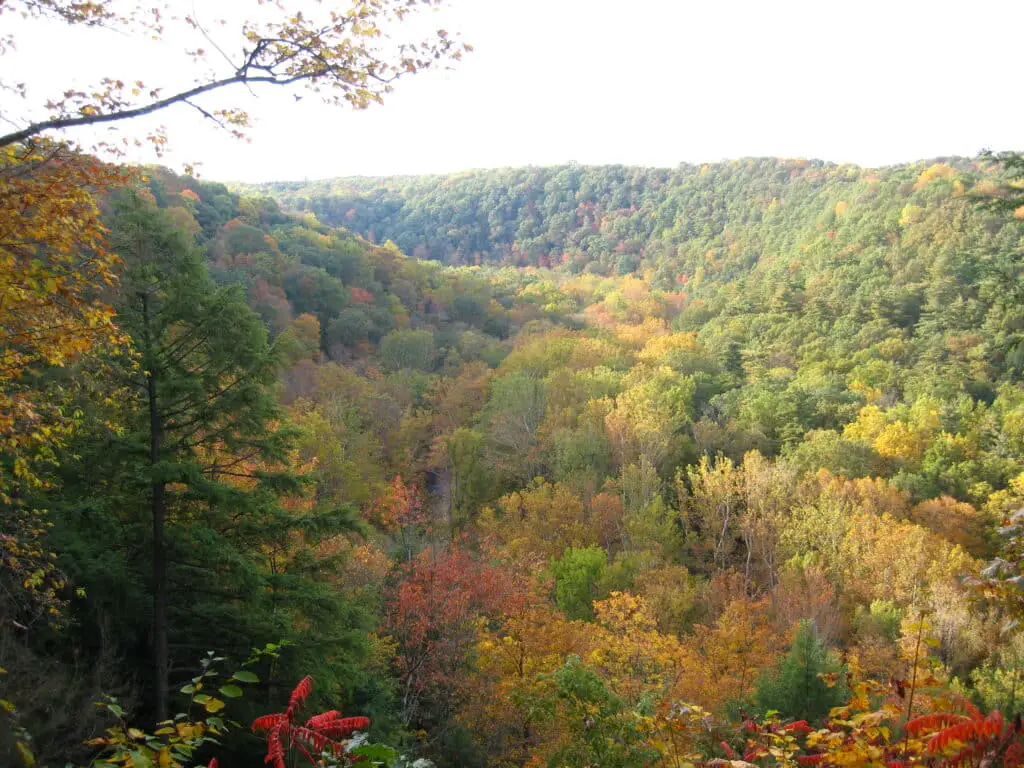
Hike through thousands of wooded acres in Mohican State park with stunning views from both land and water. While you’re at the park, you need to check out Clear Fork Gorge, Lyon’s Falls, and the covered bridge that crosses Mohican State Scenic River. You can even stay at the full-service lodge, vacation cabins, large RV campground or primitive camping area with stream side sites.
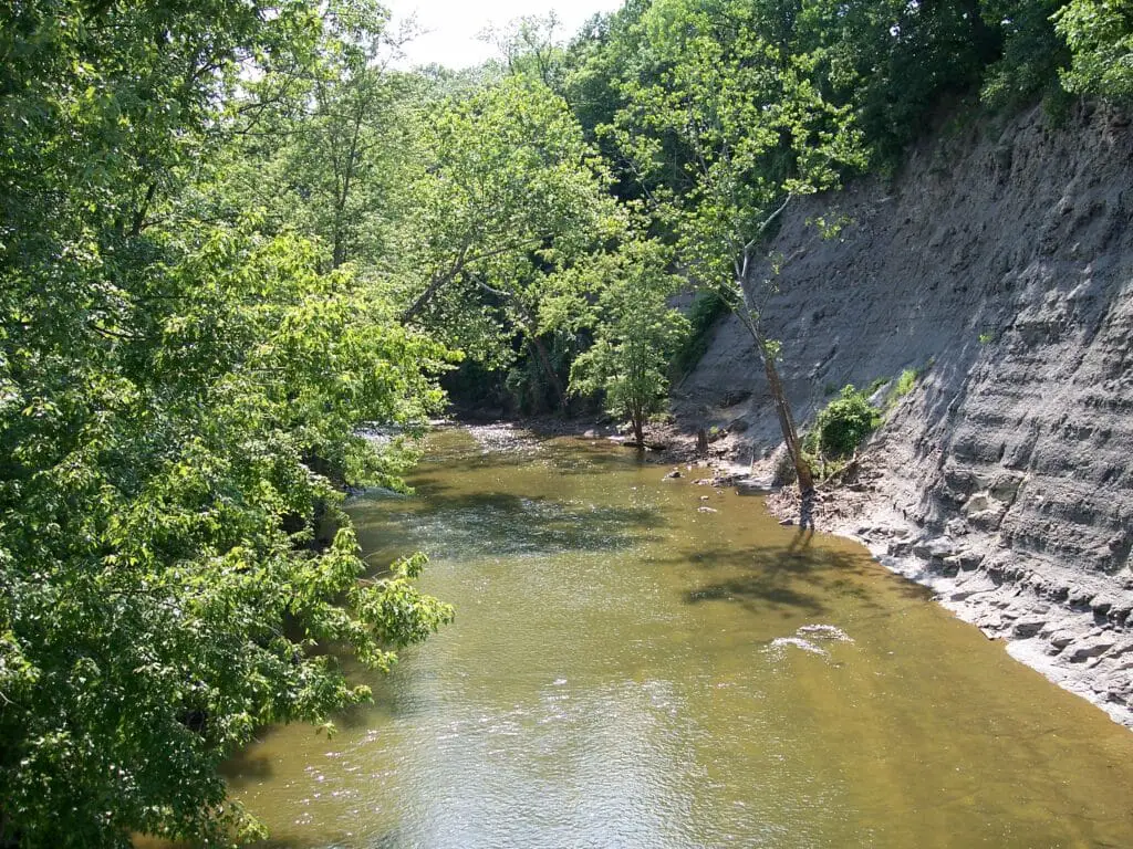
4. Deer Lick Cave Trail
Location: Brecksville Ohio (Brecksville Reservation
Trail Length: 4.2 Mile Loop
Difficulty: moderate
Completion Time: 1hr 46 minutes
Nearby Trails: Hemlock Loop Trail (2.7 miles), Old Carriage Trail (5.5 miles), Sagamore Creek Loop (3.6 miles)
The Deer Lick Cave Loop Trail is a 4 mile trail that runs through the Brecksville Reservation. At just over 4 miles, it’s one of Brecksville Reservations most secluded trails leading hikers through beautiful rolling terrain in a densely wooded forest.
Most of the trail runs along a dirt path with a few small gravel and all purpose areas leading to a cave, creek, and small waterfall. There are lots of hills on this trail and you may run into mud during the rainy season.
There are multiple access points and this trail is just a short drive from Cleveland. Brecksville Reservation is the Largest urban park in Ohio and there are multiple trails that you can choose from. While you’re at Brecksville Reservation, check out Bridle Trail Loop, Hemlock Loop Trail, Wildflower Loop Trail, and the Brecksville All Purpose trail.
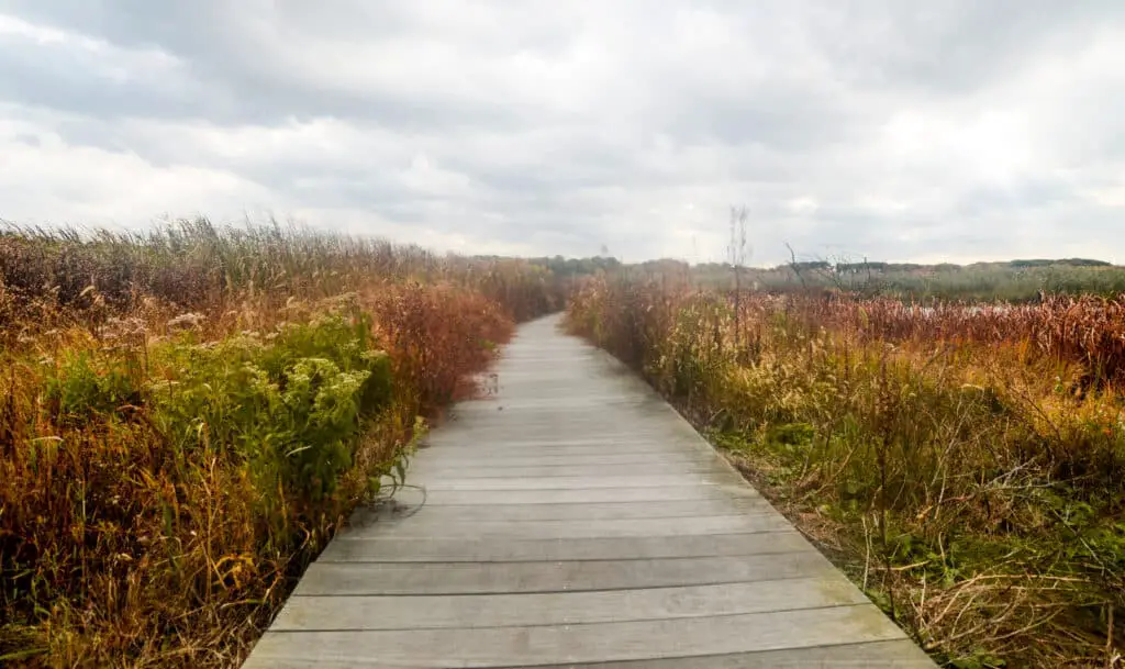
5. Lake to Lake Trail
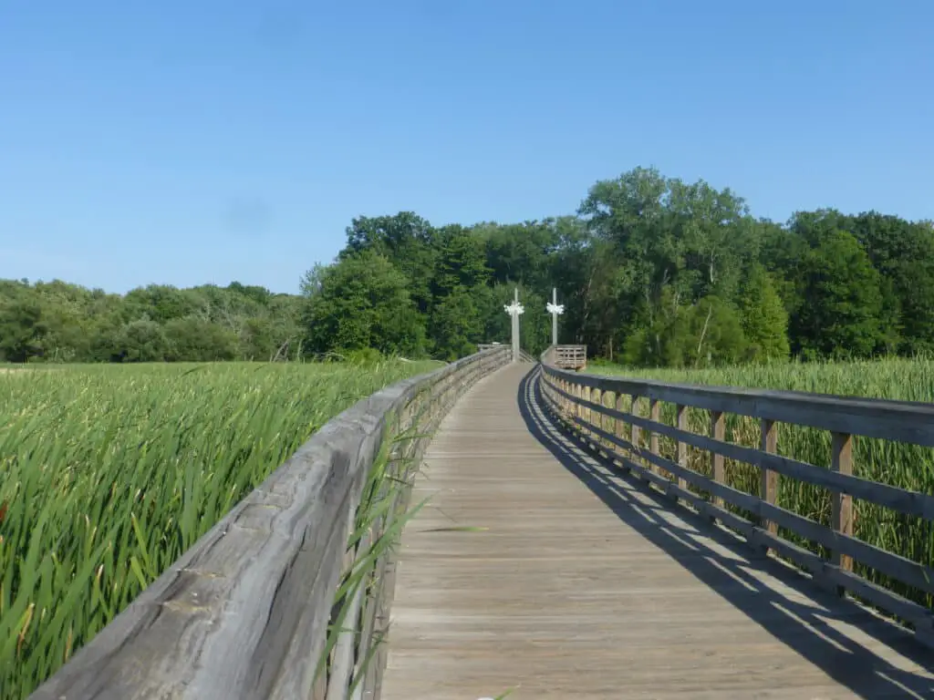
Location: Middleburg Heights, Ohio (Big Creek Reservation)
Trail Length: 5.0 Mile Out and Back
Difficulty: easy
Completion Time: 1hr 50 minutes
Nearby Trails: Fort Hill earthworks Trail (4.6 miles), Mount Pleasant Wildlife Management and Fort Hill Loop Trail (2.9 miles),
Big Creek Reservations Lake To Lake Trail is a 5 mile out and back trail near Cleveland Ohio connecting Lake Abram to Lake Isaac. This is a well maintained all-purpose paved asphalt and wood boardwalk trail running through the headwater wetlands in Cuyahoga County.
It’s a very popular all-purpose park, so you’re bound to see bikers, trail runners, other hikers, and it’s even wheel chair accessible. This is one of the easiest trails on this list with a shallow grade (5% or less) that’s perfect for families with young children. It’s a gorgeous park that’s a refreshing contrast to the surrounding urban/suburban areas.
This is a great trail to go on if you enjoy seeing animals. You’re guaranteed to see ducks, geese, birds, squirrels/chipmunks, and may even see deer if you’re lucky.
6. Cleveland Lakefront Nature Preserve Trail (Urban Downtown Trail)

- Location: Cleveland Ohio (Cleveland Lakefront Nature Preserve)
- Trail Length: 2.8 Miles
- Difficulty: easy
- Completion Time: 1hr
- Nearby Trails: Lake View Cemetery Loop (2.9 miles), Shaker Lakes Trail (4.1 miles), Edgewater Beatch Trail (1.4 miles)
One of the greatest perks of living in Cleveland Ohio are the views overlooking Lake Erie. The Cleveland Lakefront Nature Preserve Trails offers a little slice of nature just outside the city. Catch some of the best views of the Cleveland Skyline as you walk through forest lined paths leading to the lake.
This trail is an easy 2.8 mile hike around a small lakeside peninsula. Located just outside of Downtown Cleveland, this isn’t like any of the other trails on this list. It has a quaint urban feel, but it’s hard to beat the views of Lake Erie.
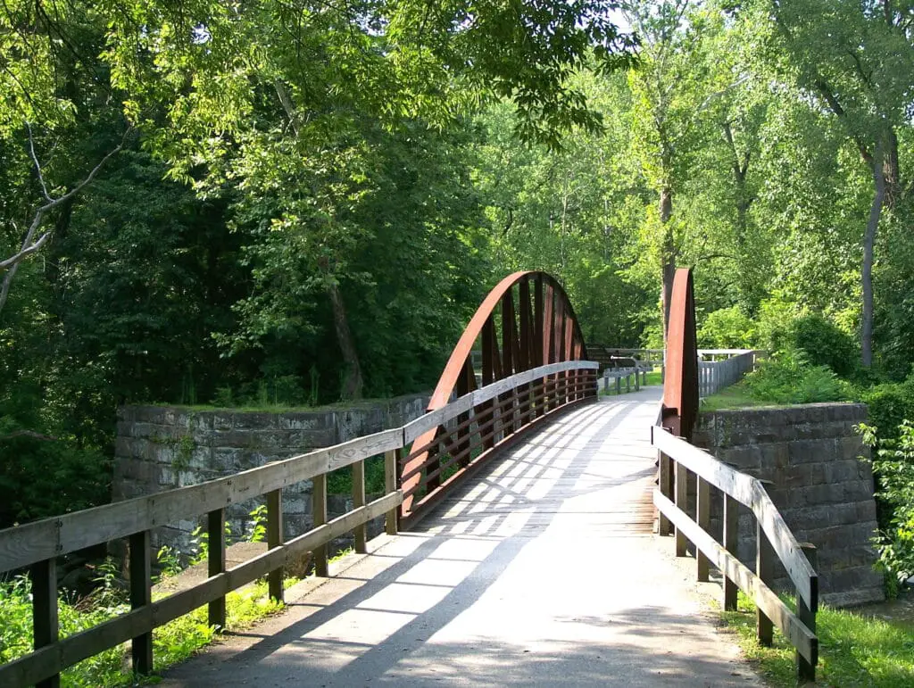
7. Ohio and Erie Canal Towpath Trail (Urban Downtown Trail)
- Location: Cleveland, Ohio
- Trail Length: 8.1 Miles
- Difficulty: Moderate
- Completion Time: 2hr 51 minutes
- Nearby Trails: Lookout Ridge Loop (1.5 miles), Edgewater Beach Trail (1.4 miles), West Ridgewood Wetland Boardwalk (2.0 miles)
This is another urban trail overlooking Downtown Cleveland. The Ohio and Erie Canal Towpath Trail that runs along the historic Ohio & Erie Canal. There’s an interesting story behind the Towpath Trail. From 1827-1913, it was used as a mule path towing canal boats filled with goods and passengers into/out of the city.
It’s one of the most historically significant trails in Ohio with the trail running from the outskirts of Cleveland to Zoar, Ohio 80 miles away (101 mile path). The scenery isn’t amazing and it runs through somewhat gritty urban section, but it’s well worth taking a short walk through history. Most people stay on the 8.1 mile paved path, so I don’t expect you to take a 101 mile hike.
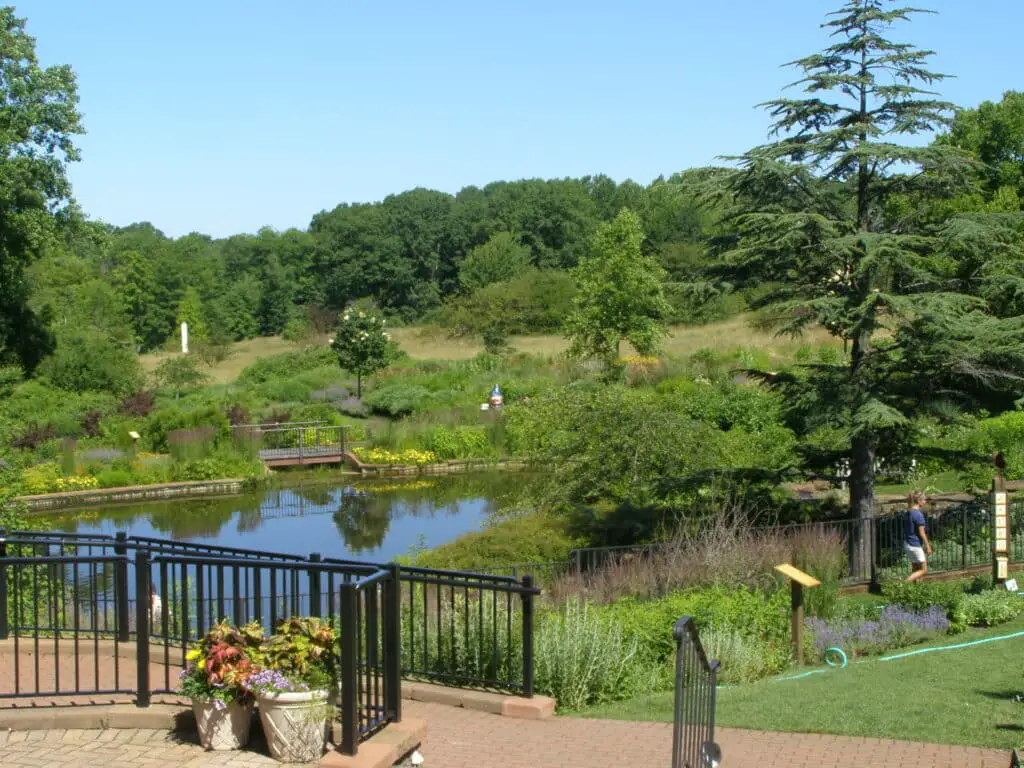
8. Holden Arboretum (Murch Canopy Walk)
- Location: Kirtland, Ohio (Holden Arboretum)
- Trail Length: 500ft Canopy Walk (Plus 20 miles of trails)
- Difficulty: moderate (120ft climb into the canopy)
- Completion Time: varies
- Nearby Trails: 20 Miles Of Trails In Holden Arboretum
The Murch Canopy Walk at the Holden Arboretum is hidden gem located in Kirtland Ohio. This is unlike any of the other trails on this list. I hope you’re not afraid of heights, because it’s a 500ft canopy walkway that’s suspended 65 ft above the forest floor.
It gives visitors a breathtaking beautiful view overlooking the Holden Arboretum. Experience a truly unique perspective of the forest and the animals that animals that live among the trees. This is a great way to spend a day exploring the outdoors from a unique vantage point.
Once you’re done with the canopy walk, take a stroll through 20 miles of trails winding through dense forests and ponds found within the Holden Arboretum. The entire park is beautiful with gardens, lakes, and there’s a 12 story tower with unrivaled views where you can see all the way to Lake Erie.
9. Black River Reservation Trails (Bridgeway Trail and Steel Mill Trail)
- Location: Elyria/Lorain, Ohio (Lorain County Metro Park System)
- Trail Length: 9.3 miles out-and-back
- Difficulty: easy
- Completion Time: 3hr 21 minutes
- Nearby Trails: French Creek Trail (2.4 miles), Black River Loop (.9 miles), High Meadows Trail
Black River Reservation in Elyria Ohio is a great place to go hiking, birding, trailing running, and cycling. It’s a flat easy trail that’s popular with local residents. So there will be a decent amount of people, but there are multiple routes so everybody’s spread out.
I recommend taking the Bridgeway Trail to Steel Mill Trail Route. It’s a beautiful winding path through the woods that runs along the river. The sceneries constantly changing and you’ll see lots of animals, birds, and wildflowers. You go over multiple bridges and there’s a waterfall you can visit down one of the side loops (adds 5-10 minutes to the hike).
Over on the steel mill section there won’t be as much wildlife, but you’ll see lots of flora and birds (filled with birds of prey). This trail might be a little bit lame for hikers that prefer technical routes, but it’s perfect for kids, seniors, and casual hikers.
10. Mentor Marsh State Nature Preserve
- Location: Mentor, Ohio (Mentor Marsh State Nature Preserve)
- Trail Length: 4 miles of trails (1.2 mile loop)
- Difficulty: easy
- Completion Time: 45 minutes
- Nearby Trails: Chagrin River Park Trail (3.1 miles), Eagle View, Shoreline, Bluff, and Lakeview Loop (2.7 miles)
The Mentor March State Nature Preserve is owned by the Cleveland Museum Of Natural History and it’s a smaller park that’s loaded with birds and other animals. There are 4 miles of trails starting off in a beech-sugar maple forest leading into the Mentor Marsh.
Make sure you take a trip down the 1/3 mile Wake Robin Trail. It’s a boardwalk trail that runs straight through the Marsh, giving you an up close look at all the local wildlife. You’ll see Yellow Perch spawning in the early spring, beaver, otters, wading birds, and waterfowl that use the March as an all you can eat buffet.
11. Nelson Ledges Trail and Cascade Falls to Devil’s Icebox
- Location: Garretsville/Parkman, Ohio (Nelson-Kennedy Ledges State Park)
- Trail Length: Nelson Ledges Trail (1.4 mile loop), Cascade Falls to Devil’s Icebox (2.0 mile loop)
- Difficulty: easy
- Completion Time: 1hr 30 minutes for both trails (plus time to explore)
- Nearby Trails: Beartown Lakes Reservation (1.9 miles), Hiram Field Station (4.9 miles), Headwaters Trail (8.4 miles)
Nelson Ledges Quarry Park is located on the border of Garretsville and Parkman Ohio. The park is mostly known for their adjacent campground (costs $5) that hosts concerts next to a large swimming hole with a sandy beach and 20ft cliff to jump into the water.
You can travel down the adjacent road to find a number of trails in the Nelson-Kennedy Ledges State Park. Hike down the 4 trails that run through the park and climb down/over the ledges, and there’s usually a waterfall that runs right through the path. Just be careful climbing the rocks because there have been a handful of fatal falls.
Northeast Ohio Hiking Trail Honorable Mentions:
12. Princess Ledges Nature Preserve
- Location: Brunswick, Ohio
- Trail Length: 1.5 miles
- Completion Time: 30 minutes
- Difficulty: easy
The Princess Ledges Nature Preserve is located in Medina County. It’s a fairly small park with 1 1/2 miles of trails, but it’s well worth the trip. You’ll find lots of birds, wildflowers, and dense forest with spectacular views of the sandstone cliffs. It used to be the Lake Erie Shoreline so you can get an idea of how steep some of the cliffs are.
13. Walter C. Best Wildlife Preserve
- Location: Chardon, Ohio
- Trail Length: 1.4 mile
- Completion Time: 30 minutes
- Difficulty: easy
Walter C. Best Wildlife Preserve is a 101 acre preservation that runs alongside the Best Sands mining operation. There are multiple trails running along the edge of Best Lake which used to be a giant sand pit. The massive sand pits are perfect for fishing and there are multiple docks jutting into the water.
14. Lake Erie Bluffs
- Location: Perry, Ohio
- Trail Length: 3/4 mile
- Completion Time: 30 minutes
- Difficulty: easy
If you head down to the Lake Erie Bluffs, there’s a good chance you’ll spot a bald eagle flying overhead. Eagle sights are common along the 3/4 mile Shoreline trail that runs through the Bluffs.
15. Chapin Forest Reservation
- Location: Kirtland Ohio
- Trail Length: 1.5 miles
- Completion Time: 40 minutes
- Difficulty: moderate
Chapin Forest Reservation is located in Kirtland Ohio and runs straight through the historic quarry. This is a difficult hike with a steep climb, but at the highest point you can see all the way to downtown Cleveland.